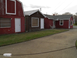
Virginia School for the Deaf and Blind (Eastern Side), Hampton, VA

Utilizing Brownfield assessment funds granted to the City of Hampton by the EPA, REMSA conducted numerous assessments of the buildings and grounds on a former state-run school for the deaf and blind within the City limits known as the Virginia School for the Deaf and Blind (VSDBH).
Langley Air Force Base Clear Zone, Hampton, VA

The Langley Clear Zone is a collection of privately owned properties surrounding the NASA/Langley Air Force Base (LAFB) in Hampton, Virginia. REMSA, Inc. has and continues to complete numerous environmental projects within the Clear Zone on behalf of the City of Hampton.
Pressey Otley Site, Hampton, VA

Pressey Otley is a mixed density residential zoned property on which all above ground structures have been demolished. Environmental assessments were requested by Hampton Redevelopment and Housing Authority (HRHA) with the intent to sell the Pressey Otley property for future residential development.
Hampton Roads Batteries-Automotive Electrical Specialists, Hampton, VA

Utilizing funds from the City of Hampton and the DEQ Virginia petroleum grant fund, REMSA conducted numerous assessments of the structure and grounds of a commercial structure within the City limits known as Hampton Roads Batteries-Automotive Electrical Specialists.
Route 60 Bridge Replacement, Newport News, VA

REMSA, Inc. provided environmental management for the U.S. Route 60 (Warwick Blvd.) bridge replacement, in Newport News, VA. The structurally deficient bridge was designed in 1937 and includes a high traffic corridor and flood zone within the Lake Maury watershed.
Abbott Trailer Park, Hampton, VA

REMSA, Inc. was contracted by the City of Hampton (COH) to complete environmental assessments, documentation, and permitting at an eight parcel property formerly known as the Abbott Trailer Park. The almost 6 acre site was comprised of vacated trailer pads, lawn, asphalt and cement pavement, a residential home, an office, a wood shop, and two storage buildings.
Mobile Physical Oceanographic Real-time System (PORTS®)
REMSA technicians and engineers maintain the NOAA PORTS® system in Mobile AL. The system consists of water level, meteorological, visibility and water current stations located in and around Mobile Bay. The picture to the right shows the Water Level Station at Dauphin Island. This station measures water levels, Winds, Air and Water temperatures and Barometric Pressure. The data is transmitted to NOAA via the GOES satellite and is available in real-time on the internet at: https://tidesandcurrents.noaa.gov/
Canaveral Harbor Expansion
Port Canaveral, Florida Project
REMSA, Inc. Canaveral Harbor Expansion Project is geared to widen and deepen the main channel of Port Canaveral and provide 24-hr environmental monitoring. Since the projects onset in May 2014 REMSA has provided Protected Species and Water Quality Monitoring per Florida Fish & Wildlife Conservation Commission (FFWCC) and The Florida Department of Environmental Protection (FDEP). The Canaveral Harbor Expansion Project is a multi-year project.


